Maps & Geospatial
ArcGIS, Dive Site, Seascape, and Marine Asset Mapping to Visualize Complex Marine Concepts
Photo by The Ocean Agency / Ocean Image Bank
Mapping Marine Resources for Better Decisions
At MMS, we transform complex marine data into clear, actionable spatial information that supports conservation planning, policy development, and sustainable resource management. Our geospatial services combine technical expertise with creative design to produce maps and tools that inform decision-making.
From comprehensive marine spatial plans to detailed dive site maps, we create visual products that help stakeholders understand where marine resources are located, how they're being used, and where conservation interventions are most needed. Our work has supported $100M+ in marine investments and informed policy decisions across multiple countries.
Whether you need technical maps for a funding proposal, interactive dashboards for monitoring programs, or spatial analysis to support marine spatial planning, MMS delivers professional geospatial products that make complex information accessible.
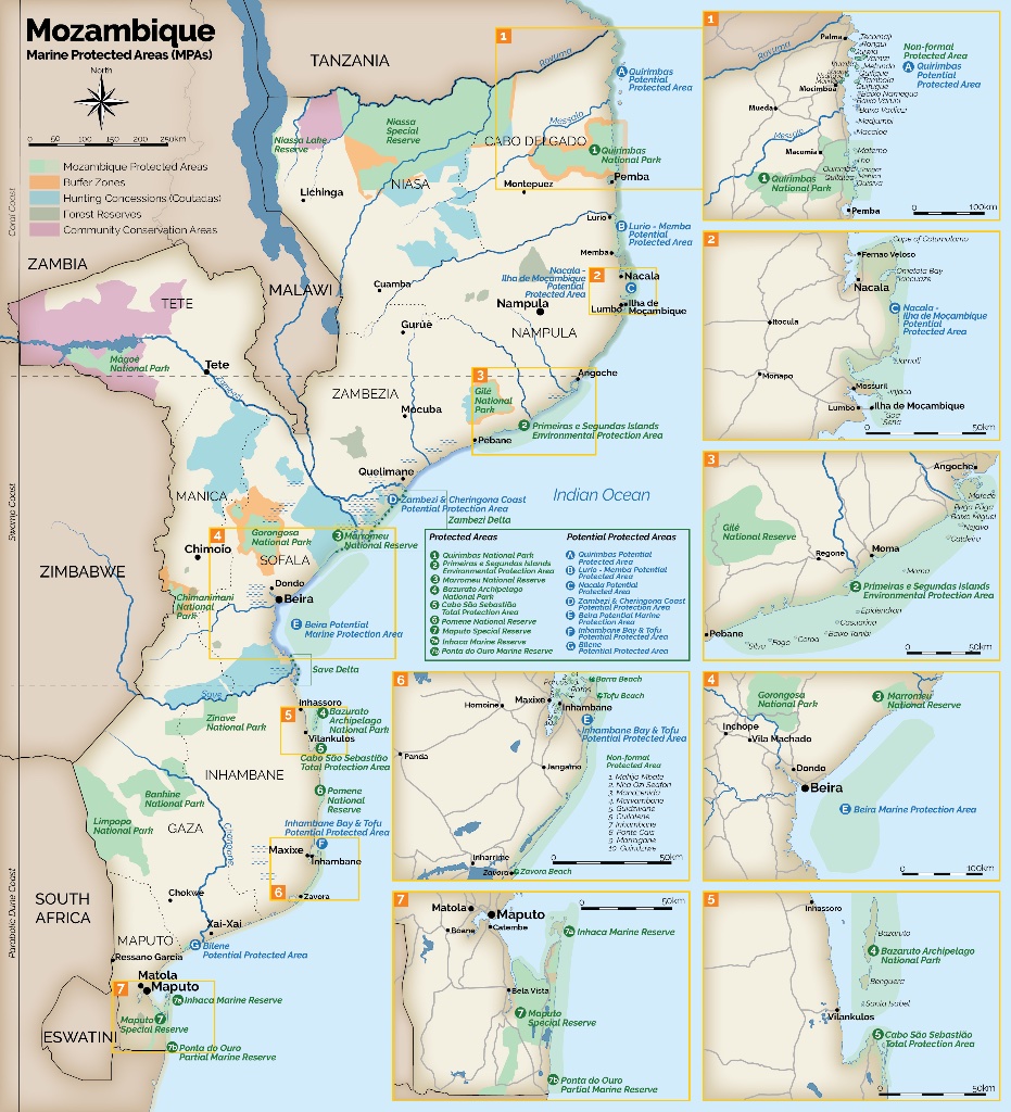
Map by Marine Market Systems
Professional Marine Mapping
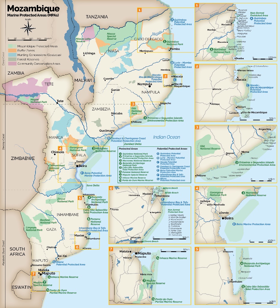
Example of our comprehensive marine spatial planning work in Mozambique
Our Geospatial Services
Professional mapping and spatial analysis services that transform data into actionable marine intelligence.
ArcGIS Mapping
Professional spatial analysis and cartography using industry-standard GIS tools
Dive Site Mapping
Detailed mapping of dive sites, marine habitats, and underwater features
Interactive Dashboards
Dynamic storyboards and dashboards that visualize complex marine data
Marine Spatial Planning
Spatial planning tools supporting policy decisions and resource management
Expert GIS & Mapping Services
Work directly with our GIS specialist to create custom mapping solutions for your project

Kailey Schillinger-Brokaw
Director of GIS Specialist and Cartography
Kailey leads our GIS and cartography services, specializing in creating bespoke maps, spatial analysis, ArcGIS StoryMaps, and interactive dashboards. She transforms complex marine data into compelling visual narratives that support informed decision-making for marine and coastal communities.
Our Mapping Process
A systematic approach that ensures accurate, useful, and visually compelling geospatial products.
Data Collection & Analysis
We gather spatial data from multiple sources including field surveys, satellite imagery, and existing databases to build comprehensive datasets.
Spatial Analysis
Using advanced GIS tools, we analyze spatial patterns, relationships, and trends to generate meaningful insights about marine environments.
Map Design & Production
We create visually compelling maps and visualizations that effectively communicate complex spatial information to diverse audiences.
Interactive Tools
We develop interactive dashboards, web maps, and storyboards that allow users to explore and interact with marine spatial data.
What You Receive
Professional geospatial products ready for publication, presentation, or web deployment.